
Modeling Urban Growth
Objective: Develop realistic projections of land use changes in urban areas using a model that incorporates demographic inputs such as population and employment projections. These projections are very useful for investigations of future air quality, climate, water quality and transportation issues.
- We have utilized the Prescott College (AZ) Spatial Growth Model (SGM) to create growth scenarios to the year 2050 for 3 urban areas: Atlanta, Washington/Baltimore and Orlando.
- Land use projections have been used as input to meteorological models; changes in land use and the associated properties can have significant impacts on surface meteorology and air quality.
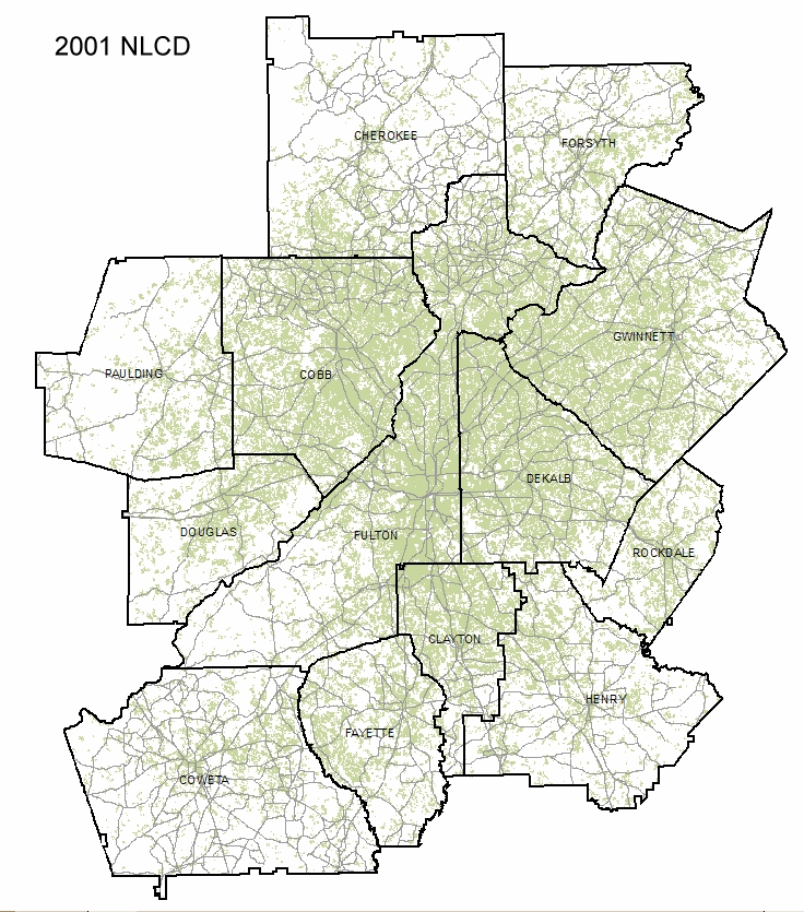
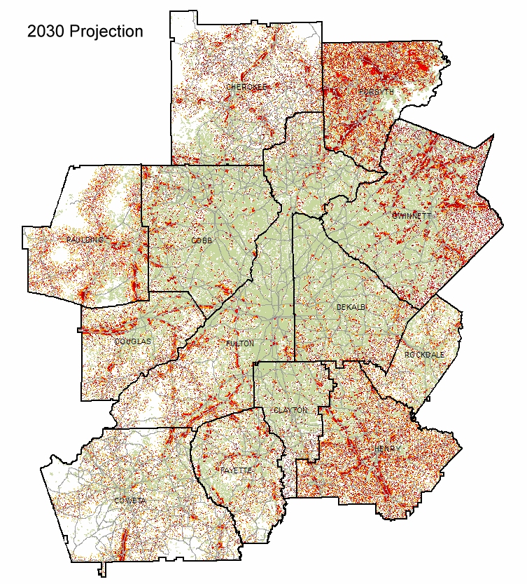
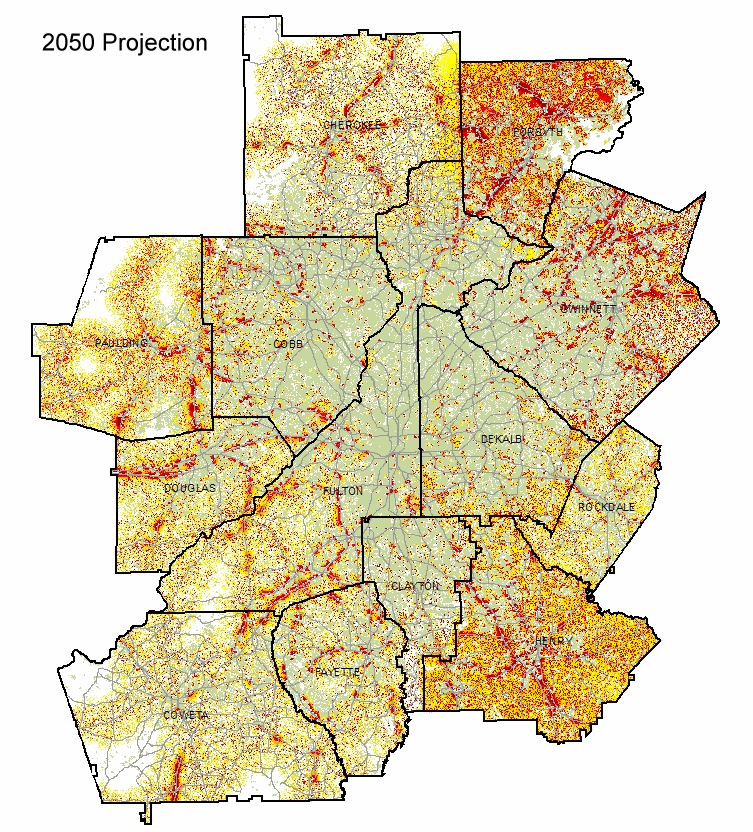
Figure 1. Current and projected land use for the 13-county metro Atlanta area. The current (2001) land use is from the National Land Cover Dataset (NLCD) in which shaded areas indicate developed land. Red and yellow areas in the projected land use images represent new development.
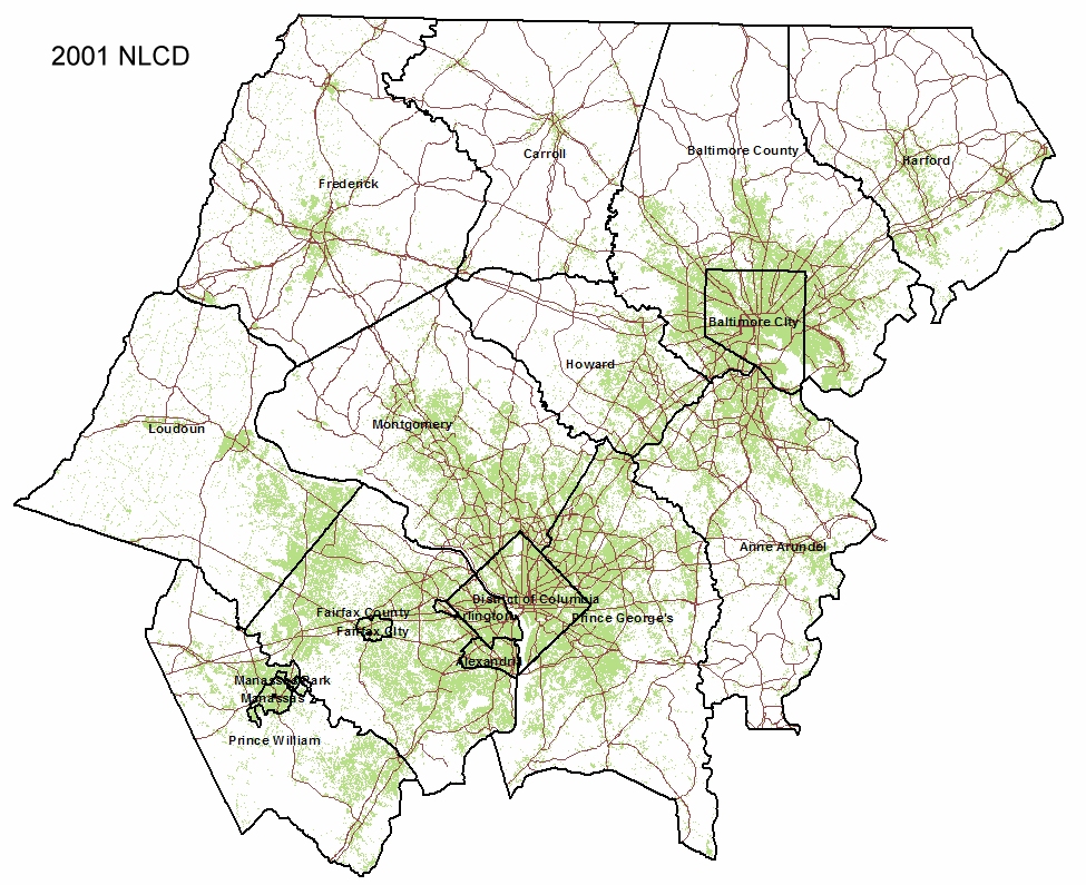
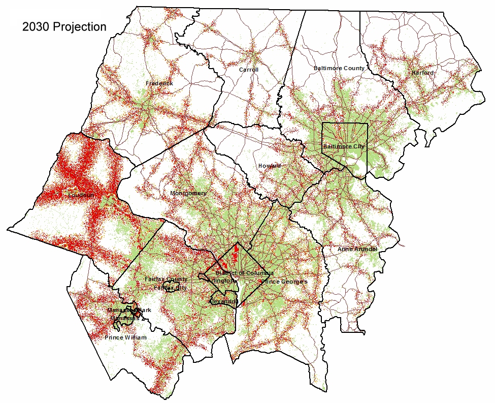
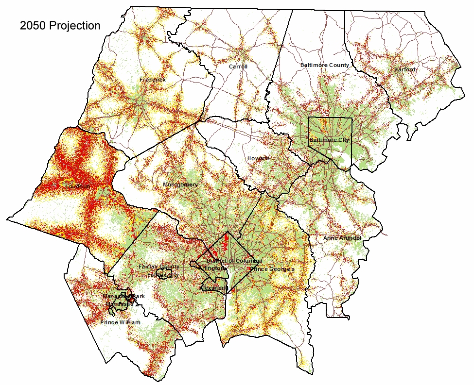
Figure 2. Current and projected land use for the Washington-Baltimore metro area. Shaded areas indicate developed land; red and yellow areas in the projected land use images represent new development.
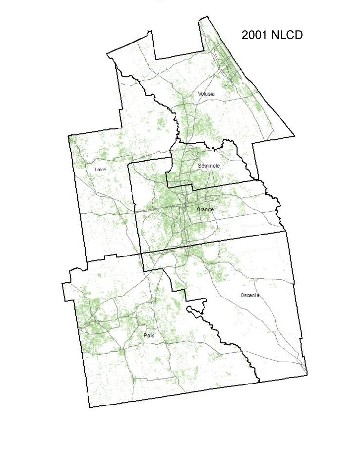
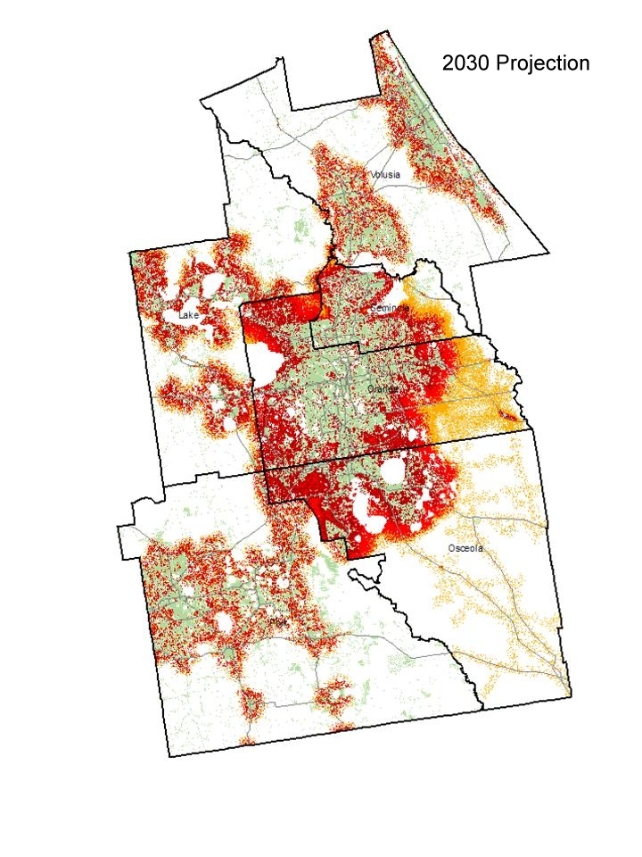
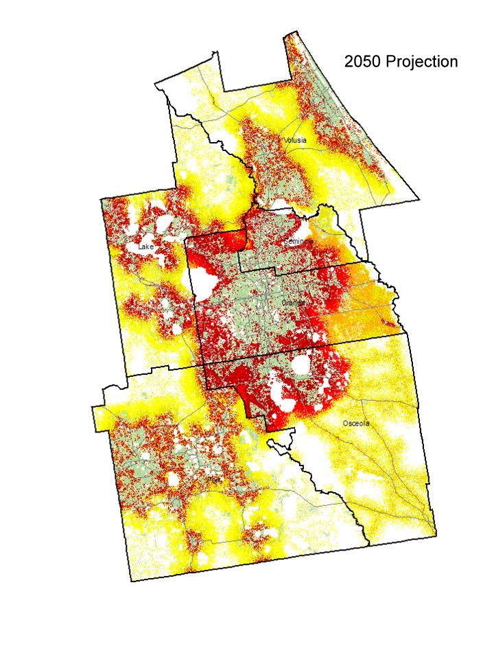
Figure 3. Current and projected land use for the Orlando metro area. Shaded areas indicate developed land; red and yellow areas in the projected land use images represent new development.
We utilized the land use projections for the year 2030 for the Atlanta area in a mesoscale meteorological model to examine the effects of the changing urban landscape on near-surface air temperatures. In a pair of model simulations representing typical summer conditions, identical inputs were used except for land use, which was specified to represent current (2000) conditions in one simulation and future (2030) land use in the second simulation.
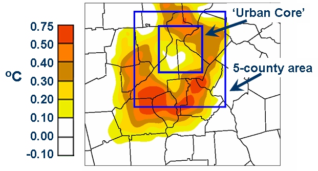
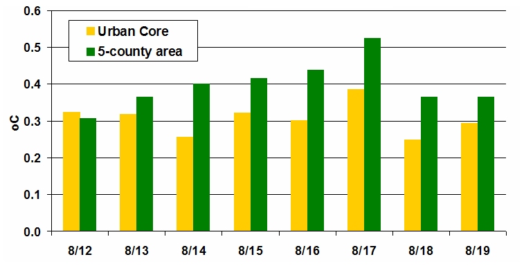
Figure 5. Average temperature differences between for 12:00 6:00 PM each day of the 8-day model simulation over the urban core and 5-county areas indicated in figure 4.
| Time Period | 5-county mean change |
Urban core mean change |
| Noon - 6 PM | 0.40°C | 0.31°C |
| 2 PM | 0.42°C | 0.28°C |
Mean near-surface air temperature changes, 2000-2030, for two daily time periods and two segments of the Atlanta metro area as indicated in figure 4.