National Aeronautics & Space Administration
George C. Marshall Space Flight Center (MSFC)
Earth Science Office
Applied Science Team (AST) Profile
Dr. Doug Rickman, AST Lead Scientist
National Space Science and Technology Center (NSSTC)
320 Sparkman Dr., Huntsville, AL, 35805
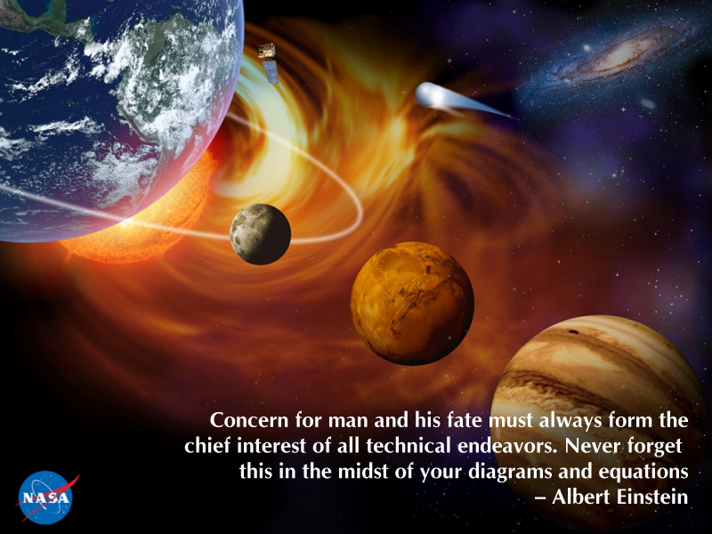
The western science and engineering enterprise has spent much of the last forty years dealing successfully with problems that owe their origin to the nineteenth century industrial revolution. Past regulatory actions were mostly reactive in nature – an implicit recognition that the generation of policy makers that came before us did not foresee environmental problems associated with their vision of progress. We are once again at another critical period in history, where rapidly expanding need for housing, food, water, and energy is placing an enormous strain on earth’s resources. New technologies and tools are emerging which carry within them enormous promise. Only a coordinated, consistent effort would ensure that these technologies evolve to become instruments of sustainability rather than environmental liability. The challenge for current generations of policy makers and scientists is not how to create a healthier and wealthier world population, but to do so with limited resources.
The MSFC Applied Science Team
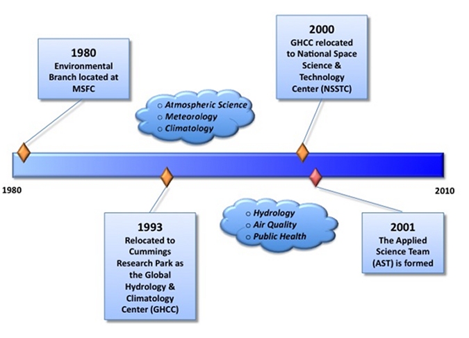
The senior members of the Marshall Space Flight Center Applied Science Team (AST) have been addressing disparate user community needs since 1980. Their work has been varied, from mapping Appalachian coal mines to processing magnetic resonance imaging (MRI) data of the human head and breast. The team members recognized that successful application of remote sensing technology is highly demanding, requiring the simultaneous abilities to do basic research, develop software and instrumentation, and communicate with user domains radically different than their own. Two highlights of the AST’s work include multi-million dollar campaigns to quantify the urban heat island phenomena and the creation of the Low Vision Enhancement System for the severely vision-handicapped.
With such experience and successes, a collective vision evolved that interdisciplinary work and an ability to communicate are key to solving many real world problems. The Applied Science Team developed out of this vision. Growing from a funding base in 2002 of approximately one million dollars a year, mostly from directed funds, the AST now competitively wins more than ten times that level of funding and has expanded its personnel resources accordingly. A continuum of skills resides within the AST, including hydrology of the land surface, airborne instrument creation, public health, air quality, and other areas, which the AST integrates as needed to address problems at whatever spatial and temporal scales are relevant to the user’s paradigm.
The Genesis of the MSFC Applied Science Team
The Applied Science Team Members
 Dr. Doug Rickman is NASA Senior Scientist at the Marshall Space Flight Center (MSFC) and the Team Lead for the Applied Science Team. Dr. Rickman received his doctorate at the University of Missouri, Rolla. He has been involved with applied sciences at NASA since 1980 and has been with MSFC since 1992. Dr. Rickman’s training and experience cover a very broad range: mineral exploration, image processing, remote sensing, software development, medical applications, and computer systems integration. He also has publications in precision agriculture, lunar regolith simulants, archaeology, urban planning, sediment transport, geometric correction of airborne imagery, low vision, and radiative transfer. His current work includes public health applications of satellite data, land processes, and development of a lunar regolith simulant. In 1994 he was inducted into the Space Technology Hall of Fame for his contributions to image processing of MRI images of the human head. Dr. Doug Rickman is NASA Senior Scientist at the Marshall Space Flight Center (MSFC) and the Team Lead for the Applied Science Team. Dr. Rickman received his doctorate at the University of Missouri, Rolla. He has been involved with applied sciences at NASA since 1980 and has been with MSFC since 1992. Dr. Rickman’s training and experience cover a very broad range: mineral exploration, image processing, remote sensing, software development, medical applications, and computer systems integration. He also has publications in precision agriculture, lunar regolith simulants, archaeology, urban planning, sediment transport, geometric correction of airborne imagery, low vision, and radiative transfer. His current work includes public health applications of satellite data, land processes, and development of a lunar regolith simulant. In 1994 he was inducted into the Space Technology Hall of Fame for his contributions to image processing of MRI images of the human head.
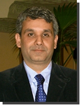
 Dr. Mohammad Al-Hamdan, a Research Scientist with the Universities Space Research Association (USRA), received his Ph.D. and M.Sc. Degrees in Civil and Environmental Engineering from the University of Alabama in Huntsville and a B.Sc. Degree in Irrigation and Drainage Engineering from Jordan University of Science and Technology. Dr. Al-Hamdan joined the Applied Science Team in 2004. His research expertise includes remote sensing and GIS applications to hydrology and air quality modeling; flow resistance characterization using spatial analysis of remotely sensed data and GIS; use of remote sensing in estimating soil moisture, as well as water resources planning and management; and applications of GIS and remote sensing and related spatial techniques to environmental assessment and public health. Dr. Al-Hamdan also serves as an adjunct assistant professor in the Civil and Environmental Engineering Department at the University of Alabama in Huntsville and an adjunct assistant professor at the School of Public Health of the University of Alabama at Birmingham. Dr. Mohammad Al-Hamdan, a Research Scientist with the Universities Space Research Association (USRA), received his Ph.D. and M.Sc. Degrees in Civil and Environmental Engineering from the University of Alabama in Huntsville and a B.Sc. Degree in Irrigation and Drainage Engineering from Jordan University of Science and Technology. Dr. Al-Hamdan joined the Applied Science Team in 2004. His research expertise includes remote sensing and GIS applications to hydrology and air quality modeling; flow resistance characterization using spatial analysis of remotely sensed data and GIS; use of remote sensing in estimating soil moisture, as well as water resources planning and management; and applications of GIS and remote sensing and related spatial techniques to environmental assessment and public health. Dr. Al-Hamdan also serves as an adjunct assistant professor in the Civil and Environmental Engineering Department at the University of Alabama in Huntsville and an adjunct assistant professor at the School of Public Health of the University of Alabama at Birmingham.
 Dr. Clay Blankenship has been a Research Scientist with USRA at the NSSTC since 2007. He earned a B.S. in Physics from Auburn University, and an M.S. and Ph.D. in Meteorology/Atmospheric Science from Texas A&M University. Dr. Blankenship’s interests include numerical modeling, remote sensing (physical retrieval methods), and data assimilation. Dr. Blankenship has integrated the SHEELS land surface model into the Land Information System (LIS) software package, and is using LIS in a coupled land-weather model to study the impact of assimilating soil moisture observations on weather forecasts. He is also involved in projects using satellite microwave radiometry to build a global climatology dataset of extreme hail events and to investigate inter-annual variations in the hydrologic cycle. Before coming to Huntsville, Dr. Blankenship was a postdoc and a civil servant at the Naval Research Laboratory in Monterey, CA, where he worked on the assimilation of satellite data into the Navy's global weather forecast system. Dr. Clay Blankenship has been a Research Scientist with USRA at the NSSTC since 2007. He earned a B.S. in Physics from Auburn University, and an M.S. and Ph.D. in Meteorology/Atmospheric Science from Texas A&M University. Dr. Blankenship’s interests include numerical modeling, remote sensing (physical retrieval methods), and data assimilation. Dr. Blankenship has integrated the SHEELS land surface model into the Land Information System (LIS) software package, and is using LIS in a coupled land-weather model to study the impact of assimilating soil moisture observations on weather forecasts. He is also involved in projects using satellite microwave radiometry to build a global climatology dataset of extreme hail events and to investigate inter-annual variations in the hydrologic cycle. Before coming to Huntsville, Dr. Blankenship was a postdoc and a civil servant at the Naval Research Laboratory in Monterey, CA, where he worked on the assimilation of satellite data into the Navy's global weather forecast system.
 Dr. William (Bill) Crosson, a Research Fellow with USRA, was awarded his Ph.D. in Meteorology from Florida State University. Dr. Crosson also earned Master of Science Degrees in Meteorology and Applied Mathematics, and a B.S. in Mathematics. Since joining the Earth Science Group, which later became the Applied Science Team, in 1991, Dr. Crosson has assumed the role of senior researcher for AST weather application efforts. Dr. Crosson’s research interests include measurement and modeling of land surface processes, especially surface-atmosphere energy exchange and the use of remotely sensed data, particularly soil moisture, to improve such models. Dr. Crosson has extensive experience developing and applying land surface flux models to simulate plot-scale to regional-scale surface water and energy balance. He is also involved in applying remote sensing data in air quality and public health applications, such as examining the impacts of air pollution and excessive urban heat. He has also been involved in numerous field experiments, including the First ISLSCP Field Experiment (FIFE-87 and FIFE-89), the 1991 Convection and Precipitation/Electrification Experiment (CaPE), the 1994 Boreal Ecosystem-Atmosphere Study (BOREAS), the Southern Great Plains ’97 Hydrology Experiment, the Huntsville ’96 and Huntsville ’98 Microwave Remote Sensing of Soil Moisture Experiments, and Soil Moisture Experiments in 2002, 2003, 2004, 2007 and 2008 (SMEX02, SMEX03, SMEX04, CLASIC, SMAP-VEX ‘08). Dr. William (Bill) Crosson, a Research Fellow with USRA, was awarded his Ph.D. in Meteorology from Florida State University. Dr. Crosson also earned Master of Science Degrees in Meteorology and Applied Mathematics, and a B.S. in Mathematics. Since joining the Earth Science Group, which later became the Applied Science Team, in 1991, Dr. Crosson has assumed the role of senior researcher for AST weather application efforts. Dr. Crosson’s research interests include measurement and modeling of land surface processes, especially surface-atmosphere energy exchange and the use of remotely sensed data, particularly soil moisture, to improve such models. Dr. Crosson has extensive experience developing and applying land surface flux models to simulate plot-scale to regional-scale surface water and energy balance. He is also involved in applying remote sensing data in air quality and public health applications, such as examining the impacts of air pollution and excessive urban heat. He has also been involved in numerous field experiments, including the First ISLSCP Field Experiment (FIFE-87 and FIFE-89), the 1991 Convection and Precipitation/Electrification Experiment (CaPE), the 1994 Boreal Ecosystem-Atmosphere Study (BOREAS), the Southern Great Plains ’97 Hydrology Experiment, the Huntsville ’96 and Huntsville ’98 Microwave Remote Sensing of Soil Moisture Experiments, and Soil Moisture Experiments in 2002, 2003, 2004, 2007 and 2008 (SMEX02, SMEX03, SMEX04, CLASIC, SMAP-VEX ‘08).
 Dr. Jennifer Edmunson, a geologist with BAE Systems, received her Ph.D. and. Master’s Degrees in planetary science (geology) at the University of New Mexico (UNM) in 2002 and 2007, respectively. Her thesis and dissertation work involved the influence of trace phases on radioisotope ages for both martian and lunar samples. She briefly taught Natural Science at UNM, and followed this work with a postdoctoral position at Marshall Space Flight Center in lunar geochemistry. Dr. Edmunson is a recent member of the Applied Science Team (2009) and the newest member of the lunar regolith simulant team at MSFC. Her role in the lunar regolith simulant team includes a multitude of responsibilities, such as providing geological simulant interpretations to users, curating simulant and simulant components, understanding user technology, and performing outreach. Dr. Jennifer Edmunson, a geologist with BAE Systems, received her Ph.D. and. Master’s Degrees in planetary science (geology) at the University of New Mexico (UNM) in 2002 and 2007, respectively. Her thesis and dissertation work involved the influence of trace phases on radioisotope ages for both martian and lunar samples. She briefly taught Natural Science at UNM, and followed this work with a postdoctoral position at Marshall Space Flight Center in lunar geochemistry. Dr. Edmunson is a recent member of the Applied Science Team (2009) and the newest member of the lunar regolith simulant team at MSFC. Her role in the lunar regolith simulant team includes a multitude of responsibilities, such as providing geological simulant interpretations to users, curating simulant and simulant components, understanding user technology, and performing outreach.
 Maury Estes, an urban and environmental planner with USRA and assistant director of USRA-Huntsville, earned a Bachelors of Science from the University of Alabama and a Master’s Degree in City Planning from Georgia Tech, with a specialization in Environmental Planning. Presently, he is pursuing a PhD in Natural Resources and Environmental Science at Alabama A&M University. A member of the Applied Science Team since 1987, Mr. Estes has over 20 years of experience in the management of science and education programs as well as Earth Science research. He served as the principal investigator for the NASA/University Joint Venture (JOVE) project from 1989 to 1999 and is now a member of the leadership team for the Tribal Earth Science and Technology Education (TRESTE) project. Current research efforts involve the use of NASA remote sensing data products for environmental public health surveillance, evaluating the impact of urbanization on air pollution, LCLU change impacts on coastal processes, and spatial growth modeling. Mr. Estes is a contributing author for “Planning and Urban Design Standards,” a reference book for planners published by Wiley and Sons in 2006, and is a co-author of “Urban Heat Islands,” a chapter in Our Changing Planet, a book published by the Cambridge University Press in 2007. Maury Estes, an urban and environmental planner with USRA and assistant director of USRA-Huntsville, earned a Bachelors of Science from the University of Alabama and a Master’s Degree in City Planning from Georgia Tech, with a specialization in Environmental Planning. Presently, he is pursuing a PhD in Natural Resources and Environmental Science at Alabama A&M University. A member of the Applied Science Team since 1987, Mr. Estes has over 20 years of experience in the management of science and education programs as well as Earth Science research. He served as the principal investigator for the NASA/University Joint Venture (JOVE) project from 1989 to 1999 and is now a member of the leadership team for the Tribal Earth Science and Technology Education (TRESTE) project. Current research efforts involve the use of NASA remote sensing data products for environmental public health surveillance, evaluating the impact of urbanization on air pollution, LCLU change impacts on coastal processes, and spatial growth modeling. Mr. Estes is a contributing author for “Planning and Urban Design Standards,” a reference book for planners published by Wiley and Sons in 2006, and is a co-author of “Urban Heat Islands,” a chapter in Our Changing Planet, a book published by the Cambridge University Press in 2007.
 Sue Estes serves as NASA’s Deputy Program Manager for Public Health Applications. She joined the AST and USRA in 2006. Ms. Estes received her B.S. from the University of Alabama in Health Care Management and a M.S. from Birmingham-Southern College in Private and Public Management with an emphasis on Health. She is involved in research utilizing public health data with remotely sensed data and analyzing the health impacts of the environment. Current research focuses on establishing partnerships between NASA environmental researchers and public health professionals in academia, federal, state and local government. As Deputy Program Manager for NASA Public Health Applications, Ms. Estes performs duties that include education, outreach, and general management of Public Health Projects within Applied Science. Ms. Estes has over 20 years of experience working in Public Health as a Hospital and Nursing Home Administrator. Sue Estes serves as NASA’s Deputy Program Manager for Public Health Applications. She joined the AST and USRA in 2006. Ms. Estes received her B.S. from the University of Alabama in Health Care Management and a M.S. from Birmingham-Southern College in Private and Public Management with an emphasis on Health. She is involved in research utilizing public health data with remotely sensed data and analyzing the health impacts of the environment. Current research focuses on establishing partnerships between NASA environmental researchers and public health professionals in academia, federal, state and local government. As Deputy Program Manager for NASA Public Health Applications, Ms. Estes performs duties that include education, outreach, and general management of Public Health Projects within Applied Science. Ms. Estes has over 20 years of experience working in Public Health as a Hospital and Nursing Home Administrator.
 Sarah Hemmings joined the AST in 2009 as a research associate with USRA, using remote sensing technology for public health, air quality, and climate research. She earned an MPH in Environmental Health from the University of Alabama at Birmingham (UAB) in 2010, with a concentration in International Health and Global Studies. As a member of the UAB–MSFC NASA DEVELOP Program team, her research focused on using remote sensing and geographic information systems to create risk maps for vector-borne diseases, such as West Nile Virus and Lyme disease. Ms. Hemmings earned a B.S. and an M.S. in Conservation Ecology and Sustainable Development from the University of Georgia in 2005, specializing in water quality research on microbial source tracking and endocrine disruption. She was awarded a fellowship from the National Oceanic and Atmospheric Administration to conduct water quality research on the Georgian and Puerto Rican coasts. Prior to joining the AST, Ms. Hemmings served as the Assistant Director of International Programs and Services at the University of Alabama in Huntsville. In this capacity, she developed and administered international exchange programs in partnership with the U.S. Department of State and other agencies. Sarah Hemmings joined the AST in 2009 as a research associate with USRA, using remote sensing technology for public health, air quality, and climate research. She earned an MPH in Environmental Health from the University of Alabama at Birmingham (UAB) in 2010, with a concentration in International Health and Global Studies. As a member of the UAB–MSFC NASA DEVELOP Program team, her research focused on using remote sensing and geographic information systems to create risk maps for vector-borne diseases, such as West Nile Virus and Lyme disease. Ms. Hemmings earned a B.S. and an M.S. in Conservation Ecology and Sustainable Development from the University of Georgia in 2005, specializing in water quality research on microbial source tracking and endocrine disruption. She was awarded a fellowship from the National Oceanic and Atmospheric Administration to conduct water quality research on the Georgian and Puerto Rican coasts. Prior to joining the AST, Ms. Hemmings served as the Assistant Director of International Programs and Services at the University of Alabama in Huntsville. In this capacity, she developed and administered international exchange programs in partnership with the U.S. Department of State and other agencies.
 Daniel Irwin is a NASA research scientist with over 17 years of experience in satellite remote sensing applications and Geographic Information Systems (GIS) in the developing world. Daniel is currently the Principal Investigator for SERVIR—the Regional Visualization and Monitoring System, which was developed at NASA’s Marshall Space Flight Center and consists of operational facilities in Panama City, Panama and in Nairobi, Kenya. SERVIR is considered an important achievement of the Global Earth Observation System of Systems (GEOSS) – a 70+ country effort to develop a 21st century earth observation system for environmental management and disaster response. Prior to joining NASA, Daniel lived and worked in Guatemala, developing leading GIS laboratories for conservation organizations and the Guatemalan government. A primary objective of his work was to demonstrate how NASA data could be used for forest conservation and economic development throughout the tropics. In 2008, Daniel received the Charles S. Falkenberg Award, presented jointly by the American Geophysical Union and the Earth Science Information Partnership. The award honors "a scientist under 45 years of age who has contributed to the quality of life, economic opportunities and stewardship of the planet through the use of Earth science information and to the public awareness of the importance of understanding our planet." Daniel was also a 2008 finalist for the Service to America Medals (Sammies), which highlight public servants who have made significant contributions to the United States based on their commitment and innovation, as well as the impact of their work on addressing the needs of the nation. Daniel Irwin is a NASA research scientist with over 17 years of experience in satellite remote sensing applications and Geographic Information Systems (GIS) in the developing world. Daniel is currently the Principal Investigator for SERVIR—the Regional Visualization and Monitoring System, which was developed at NASA’s Marshall Space Flight Center and consists of operational facilities in Panama City, Panama and in Nairobi, Kenya. SERVIR is considered an important achievement of the Global Earth Observation System of Systems (GEOSS) – a 70+ country effort to develop a 21st century earth observation system for environmental management and disaster response. Prior to joining NASA, Daniel lived and worked in Guatemala, developing leading GIS laboratories for conservation organizations and the Guatemalan government. A primary objective of his work was to demonstrate how NASA data could be used for forest conservation and economic development throughout the tropics. In 2008, Daniel received the Charles S. Falkenberg Award, presented jointly by the American Geophysical Union and the Earth Science Information Partnership. The award honors "a scientist under 45 years of age who has contributed to the quality of life, economic opportunities and stewardship of the planet through the use of Earth science information and to the public awareness of the importance of understanding our planet." Daniel was also a 2008 finalist for the Service to America Medals (Sammies), which highlight public servants who have made significant contributions to the United States based on their commitment and innovation, as well as the impact of their work on addressing the needs of the nation.
 Dr. Maudood Khan, a research scientist with USRA, completed his doctoral research work at Georgia Tech in 2003, during which he developed the next generation air quality model (i.e., adaptive grid air quality model). Dr. Khan joined the Applied Science Team in 2007. As the senior scientist for air quality, his research interests include modeling of atmospheric dynamics and chemistry at high spatial resolution, and use of remotely sensed observations for improved model predictions as well as for performance evaluation. He is currently pursuing a graduate degree (part-time) in International Science and Technology Policy, with focus on Space Policy, at the Elliot School of International Affairs, George Washington University. Until December 2009, Dr. Khan was working (part-time) as a Principal Engineer with the Air Protection Branch (APB) of the Georgia Department of Natural Resources (DNR). He began his career with APB as a Research Associate in 1999. He was instrumental in establishing atmospheric modeling capabilities at APB, conducting modeling simulations in support of air quality management plans aimed at improving local and regional air quality. He was a member of the Technical Analysis Work Group (TAWG) of the Visibility Improvement in State and Tribal Association of the South (VISTAS), a Regional Planning Organization established by the United States Congress, and tasked with the development of air quality management plans. Dr. Maudood Khan, a research scientist with USRA, completed his doctoral research work at Georgia Tech in 2003, during which he developed the next generation air quality model (i.e., adaptive grid air quality model). Dr. Khan joined the Applied Science Team in 2007. As the senior scientist for air quality, his research interests include modeling of atmospheric dynamics and chemistry at high spatial resolution, and use of remotely sensed observations for improved model predictions as well as for performance evaluation. He is currently pursuing a graduate degree (part-time) in International Science and Technology Policy, with focus on Space Policy, at the Elliot School of International Affairs, George Washington University. Until December 2009, Dr. Khan was working (part-time) as a Principal Engineer with the Air Protection Branch (APB) of the Georgia Department of Natural Resources (DNR). He began his career with APB as a Research Associate in 1999. He was instrumental in establishing atmospheric modeling capabilities at APB, conducting modeling simulations in support of air quality management plans aimed at improving local and regional air quality. He was a member of the Technical Analysis Work Group (TAWG) of the Visibility Improvement in State and Tribal Association of the South (VISTAS), a Regional Planning Organization established by the United States Congress, and tasked with the development of air quality management plans.
 Dr. Charles A. Laymon, a research fellow with USRA, received a B.S. degree in geology with honors from St. Lawrence University, and a Ph.D. degree in geological sciences in 1988 from the University of Colorado. Dr. Laymon’s research interests include remote sensing of land surface properties and processes, such as soil moisture, vegetation parameters, surface temperature, and energy fluxes, and the assimilation of these data in hydrologic and climate models for a wide variety of applications. He received the Sigma Xi award in 1982 for excellence in undergraduate research. He has served on the NASA Aqua mission AMSR-E science team and AGU Hydrology Section, Remote Sensing Committee. Dr. Laymon currently leads a team developing passive microwave instrument systems and serves on various working groups of the NASA Soil Moisture Active/Passive (SMAP) mission. Dr. Charles A. Laymon, a research fellow with USRA, received a B.S. degree in geology with honors from St. Lawrence University, and a Ph.D. degree in geological sciences in 1988 from the University of Colorado. Dr. Laymon’s research interests include remote sensing of land surface properties and processes, such as soil moisture, vegetation parameters, surface temperature, and energy fluxes, and the assimilation of these data in hydrologic and climate models for a wide variety of applications. He received the Sigma Xi award in 1982 for excellence in undergraduate research. He has served on the NASA Aqua mission AMSR-E science team and AGU Hydrology Section, Remote Sensing Committee. Dr. Laymon currently leads a team developing passive microwave instrument systems and serves on various working groups of the NASA Soil Moisture Active/Passive (SMAP) mission.
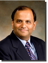 Dr. Ashutosh Limaye works with NASA MSFC as the science applications coordinator of SERVIR— the Regional Visualization and Monitoring System. SERVIR is an initiative that applies earth observations and predictive models to support decision-making. Dr. Limaye has worked with the Applied Science Team since 1997 as the senior scientist for hydrology and water resources. Dr. Limaye received a B.S. degree in civil engineering from Pune University in India, and M. S. and Ph.D. degrees in civil and environmental engineering from Utah State University. His research interests include use of remotely sensed data in hydrology and water resources, mathematical optimization, and agricultural yield estimation under changing agricultural and climatic conditions. He is currently leading a group of scientists to improve operational hydrologic modeling and streamflow estimation using NASA remotely sensed datasets. Recently, he has become involved in development of microwave radiometer and antenna systems for remote sensing of soil moisture. Dr. Ashutosh Limaye works with NASA MSFC as the science applications coordinator of SERVIR— the Regional Visualization and Monitoring System. SERVIR is an initiative that applies earth observations and predictive models to support decision-making. Dr. Limaye has worked with the Applied Science Team since 1997 as the senior scientist for hydrology and water resources. Dr. Limaye received a B.S. degree in civil engineering from Pune University in India, and M. S. and Ph.D. degrees in civil and environmental engineering from Utah State University. His research interests include use of remotely sensed data in hydrology and water resources, mathematical optimization, and agricultural yield estimation under changing agricultural and climatic conditions. He is currently leading a group of scientists to improve operational hydrologic modeling and streamflow estimation using NASA remotely sensed datasets. Recently, he has become involved in development of microwave radiometer and antenna systems for remote sensing of soil moisture.
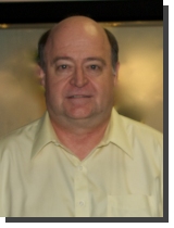 Dr. Jeff Luvall, a senior research scientist with NASA since 1985, earned his Ph.D. from the University of Georgia. As a member of the Applied Science Team since 1990, Dr. Luvall has specialized in quantifying surface energy budgets on a landscape scale across many types of ecosystems using a variety of aircraft-based multispectral visible and thermal scanners. These investigations have resulted in the development of a Thermal Response Number (TRN), which can be used to classify land surfaces in regional surface budget modeling by their energy partitioning. He has been the principle investigator of a U.S. Environmental Protection Agency funded project to quantify the urban surface fabric, which produces the urban heat island effect for 3 U.S. cities. He is currently working on a similar NASA funded project for a tropical city (San Juan, PR). His work in ecological thermodynamics and remote sensing has led to its application to predicting agricultural yield and the theoretical use of remote sensing technology and resources, to directly measure the "real time" binding of carbon by photosynthesis in vegetated systems. He is internationally recognized as a teacher with his appointment (1999-2000) to the Walter Bean/Canada Trust Fellowship, Visiting Professor in the Environment, Faculty of Engineering, University of Waterloo, Waterloo, Canada. Dr. Jeff Luvall, a senior research scientist with NASA since 1985, earned his Ph.D. from the University of Georgia. As a member of the Applied Science Team since 1990, Dr. Luvall has specialized in quantifying surface energy budgets on a landscape scale across many types of ecosystems using a variety of aircraft-based multispectral visible and thermal scanners. These investigations have resulted in the development of a Thermal Response Number (TRN), which can be used to classify land surfaces in regional surface budget modeling by their energy partitioning. He has been the principle investigator of a U.S. Environmental Protection Agency funded project to quantify the urban surface fabric, which produces the urban heat island effect for 3 U.S. cities. He is currently working on a similar NASA funded project for a tropical city (San Juan, PR). His work in ecological thermodynamics and remote sensing has led to its application to predicting agricultural yield and the theoretical use of remote sensing technology and resources, to directly measure the "real time" binding of carbon by photosynthesis in vegetated systems. He is internationally recognized as a teacher with his appointment (1999-2000) to the Walter Bean/Canada Trust Fellowship, Visiting Professor in the Environment, Faculty of Engineering, University of Waterloo, Waterloo, Canada.
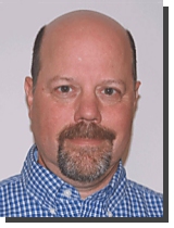
 Paul Meyer, an Atmospheric Scientist with MSFC, holds a B.S. and M.S. in Meteorology and an M.S. in Computer Science. He has served as a team member at NASA MSFC for the past 24 years. His interests have been in scientific data visualization and image processing. He has conducted research in precipitation systems using weather radar and has developed algorithms to determine vortex centers for tornadic storm cells. He performed image analysis work for the 1986 Space Shuttle Challenger investigation and for the 2003 Space Shuttle Columbia accident. He is the co-developer of the Video Image Stabilization and Registration (VISAR) technique which earned NASA's 2003 Commercial Invention of the Year award. VISAR was developed in response to a request from the FBI to assist them in the investigation of the 1996 Atlanta Olympic Park bombings. Additionally, he and the VISAR technology have been inducted into the Space Technology Hall of Fame and VISAR has won numerous other awards. Mr. Meyer holds five United States patents and one Australian patent. Mr. Meyer develops interactive visualization techniques for remote sensing data using the World Wide Web. His recent interests include the use of multi-frequency GPS signals to characterize biogeophysical properties of vegetation. Paul Meyer, an Atmospheric Scientist with MSFC, holds a B.S. and M.S. in Meteorology and an M.S. in Computer Science. He has served as a team member at NASA MSFC for the past 24 years. His interests have been in scientific data visualization and image processing. He has conducted research in precipitation systems using weather radar and has developed algorithms to determine vortex centers for tornadic storm cells. He performed image analysis work for the 1986 Space Shuttle Challenger investigation and for the 2003 Space Shuttle Columbia accident. He is the co-developer of the Video Image Stabilization and Registration (VISAR) technique which earned NASA's 2003 Commercial Invention of the Year award. VISAR was developed in response to a request from the FBI to assist them in the investigation of the 1996 Atlanta Olympic Park bombings. Additionally, he and the VISAR technology have been inducted into the Space Technology Hall of Fame and VISAR has won numerous other awards. Mr. Meyer holds five United States patents and one Australian patent. Mr. Meyer develops interactive visualization techniques for remote sensing data using the World Wide Web. His recent interests include the use of multi-frequency GPS signals to characterize biogeophysical properties of vegetation.
 Dr. Dale Quattrochi has been a geographer and senior research scientist with NASA since 1980. Dr. Quattrochi received his B.S. from Ohio University, his M.S. from the University of Tennessee, and his Ph.D. from the University of Utah, all in geography. As a member of the Applied Science Team, his research focuses on the applications of remote sensing to public health, thermal remote sensing for analysis of land surface energy fluxes, and remote sensing of the urban heat island effect. Dr. Quattrochi has received numerous awards including the NASA Medal for Exceptional Scientific Achievement, NASA’s highest science award, the Association of American Geographers’ Remote Sensing Specialty Group’s Outstanding Contributions Award, and the Ohio University College of Arts and Sciences Distinguished Alumni Award. He has co-edited three books on remote sensing: Scale in Remote Sensing and GIS, Thermal Remote Sensing in Land Surface Processes, and Urban Remote Sensing. Dr. Dale Quattrochi has been a geographer and senior research scientist with NASA since 1980. Dr. Quattrochi received his B.S. from Ohio University, his M.S. from the University of Tennessee, and his Ph.D. from the University of Utah, all in geography. As a member of the Applied Science Team, his research focuses on the applications of remote sensing to public health, thermal remote sensing for analysis of land surface energy fluxes, and remote sensing of the urban heat island effect. Dr. Quattrochi has received numerous awards including the NASA Medal for Exceptional Scientific Achievement, NASA’s highest science award, the Association of American Geographers’ Remote Sensing Specialty Group’s Outstanding Contributions Award, and the Ohio University College of Arts and Sciences Distinguished Alumni Award. He has co-edited three books on remote sensing: Scale in Remote Sensing and GIS, Thermal Remote Sensing in Land Surface Processes, and Urban Remote Sensing.
|