
Other Links
Arenal Region, Costa Rica
TIMS Images of Footpaths
 TIMS
data showing potential locations of prehistoric footpaths in the forest
canopy. The linear features have been accentuated in the image to emphasize
their location.
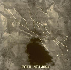
TIMS
data showing potential locations of prehistoric footpaths in the forest
canopy. The linear features have been accentuated in the image to emphasize
their location.
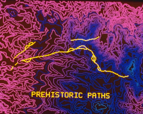
Footpath segments overlayed on topographic data. It is postulated that the
loops along the paths were used to carry heavy loads or help the aged and
infirm negotiate steep hillsides.
Responsible Official: Dr. James L. Smoot (James.L.Smoot@nasa.gov)
Page Author: Tom Sever
Page Curator: Diane Samuelson (diane.samuelson@msfc.nasa.gov)