The Petén, Guatemala
Daniel Lee
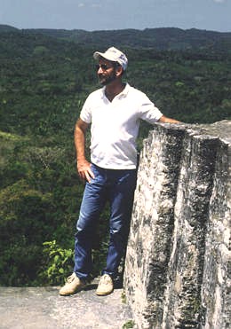 Daniel Lee is a GIS expert and President of Geotek, a company that specializes
in geographic technology. He has been supporting remote sensing and archeological
research since 1981 and has conducted interdisciplinary ground verification
studies around the globe. For this project, he oversees the GIS analysis,
GPS collection, data integration, and field logistics. In addition to his
computer skills, he is a pilot, mechanic, musician, and rugged outdoorsman
who provides endless wit and humor to the team members throughout the fieldwork.
He has designed sate-of-the-art instrumentation both for the acquisition
of high-resolution remotely sensed data and for the collection of ground
truth information. This instrumentation is of great value for current and
future archeological and interdisciplinary research. Daniel Lee is a GIS expert and President of Geotek, a company that specializes
in geographic technology. He has been supporting remote sensing and archeological
research since 1981 and has conducted interdisciplinary ground verification
studies around the globe. For this project, he oversees the GIS analysis,
GPS collection, data integration, and field logistics. In addition to his
computer skills, he is a pilot, mechanic, musician, and rugged outdoorsman
who provides endless wit and humor to the team members throughout the fieldwork.
He has designed sate-of-the-art instrumentation both for the acquisition
of high-resolution remotely sensed data and for the collection of ground
truth information. This instrumentation is of great value for current and
future archeological and interdisciplinary research.
Responsible Official: Dr. James L. Smoot (James.L.Smoot@nasa.gov)
Page Author: Tom Sever
Page Curator: Diane Samuelson (diane.samuelson@msfc.nasa.gov)
|