The Petén, Guatemala
Frank Miller
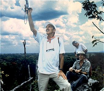 Frank Miller is a forester, soil scientist, GIS and
image analyst, GPS expert, and photo interpreter who can identify every species of growth and every type
of soil in the Petén. He retired as a Professor of Forestry and
Director of the Mississippi Remote Sensing Center at Mississippi State
University in 1994, but continues to work as a consultant in Tropical Ecology &
Forest Management. He served as Territorial Forester for American Samoa
between 1995-1996. Frank is an expert at matching satellite/airborne
data with features on the ground. Athletic and handy with a machete, Frank
earns the role of gathering GPS measurements from tree tops, eroded temple
structures, and other difficult locations. He is an experienced researcher
who has conducted over 35 years of interdisciplinary research in Central and South America, the
Pacific Islands, and the Mideast. Frank Miller is a forester, soil scientist, GIS and
image analyst, GPS expert, and photo interpreter who can identify every species of growth and every type
of soil in the Petén. He retired as a Professor of Forestry and
Director of the Mississippi Remote Sensing Center at Mississippi State
University in 1994, but continues to work as a consultant in Tropical Ecology &
Forest Management. He served as Territorial Forester for American Samoa
between 1995-1996. Frank is an expert at matching satellite/airborne
data with features on the ground. Athletic and handy with a machete, Frank
earns the role of gathering GPS measurements from tree tops, eroded temple
structures, and other difficult locations. He is an experienced researcher
who has conducted over 35 years of interdisciplinary research in Central and South America, the
Pacific Islands, and the Mideast.
Responsible Official: Dr. James L. Smoot (James.L.Smoot@nasa.gov)
Page Author: Tom Sever
Page Curator: Diane Samuelson (diane.samuelson@msfc.nasa.gov)
|