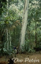
The Petén, Guatemala
Maya Biosphere Reserve
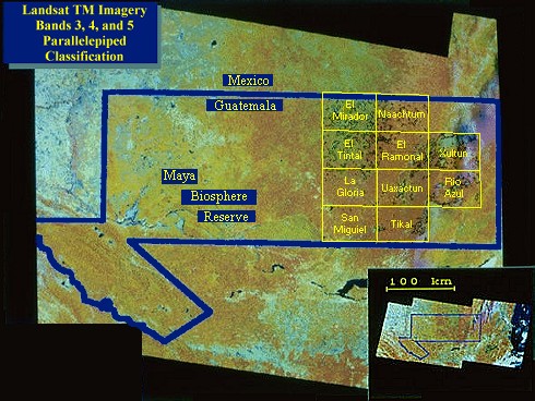
A Geographic Information System (GIS) is currently being constructed containing
ancillary data, such as topography, soils, drainage, etc. over the Petén.
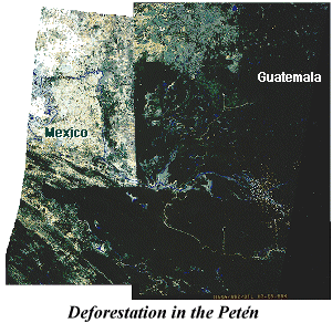 Landsat satellite image of the Mexican/Guatemalan
border. The image shows the impact of a high rural population upon the rainforest.
Guatemala's sparsely populated Petén rainforest stands in contrast
to the stripped and tilled landscape of Mexico. Landsat satellite image of the Mexican/Guatemalan
border. The image shows the impact of a high rural population upon the rainforest.
Guatemala's sparsely populated Petén rainforest stands in contrast
to the stripped and tilled landscape of Mexico.
Responsible Official: Dr. James L. Smoot (James.L.Smoot@nasa.gov)
Page Author: Tom Sever
Page Curator: Diane Samuelson (diane.samuelson@msfc.nasa.gov)
|