Remote Sensing
Arenal, Costa Rica
Chaco Canyon, NM
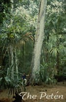
The Petén, Guatemala
Archeology Home
ESO Home
Other Links
Mayan
World
Maya
of Guatemala
Biosphere
Change Detection |
The Petén, Guatemala
Remotely Sensed Features
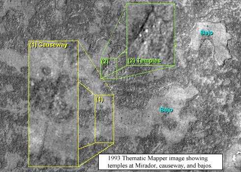
TM satellite image created by ratioing Band 4 with Band 3.
The white spots represent ancient Mayan temple structures beneath the forest
canopy at the archeological site at Mirador, while the dark lines represent
Mayan causeways and natural geologic features. Ground reconnaissance and
sometimes excavation are required to separate the cultural from the natural
features. |
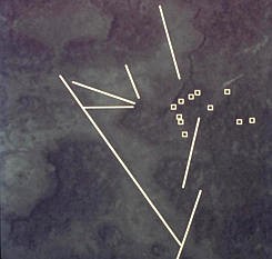
Graphic overlay of temple location and potential causeway at Mirador. |
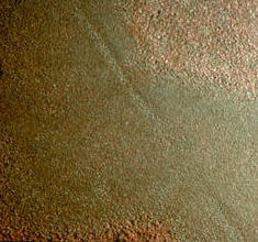
Photograph based on color infrared (CIR) image of the bajo to the immediate
west of Mirador. The linear feature is a Mayan causeway. The causeways are
artifacts from the past and assist in regional analysis since they provide
insight into how Mayan cities were connected politically and economically. |
Responsible Official: Dr. James L. Smoot (James.L.Smoot@nasa.gov)
Page Author: Tom Sever
Page Curator: Diane Samuelson (diane.samuelson@msfc.nasa.gov)
|
|