


Experiments
 Soil Moisture Experiments in 2003 supported the science needs of Soil Moisture Missions (HYDROS and future), GWEC, and AMSR. Main elements of the experiment were similar to SMEX02: to understand land-atmosphere interactions, validation of AMSR brightness temperature and soil moisture retrievals, extension of instrument observations and algorithms to more challenging vegetation conditions, and the evaluation of new instrument technologies for soil moisture remote sensing. However, whereas SMEX02 focused on an agricultural setting, SMEX03 addresses validation in a range of natural vegetation types.
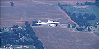
 Investigators from the Global Hydrology and Climate Center participated in the field campaign in northern Alabama and southern Tennessee. SMEX03 is a joint USDA-Agricultural Research Service and NASA R&D experiment whose primary objectives were to validate soil moisture retrieval algorithms from NASA’s AMSR-E. To support this experiment, the NASA P-3B Orion aircraft was based in Huntsville, Alabama from June 23 to July 2. The aircraft was equipped with a payload of passive microwave remote sensing instruments (Polarimetric Scanning Radiometer) to collect data on surface soil moisture (Figure 1 and 2, right and left). The aircraft flew five missions over northern Alabama and three missions near Tifton, Georgia. By all accounts the aircraft and instruments performed flawlessly.
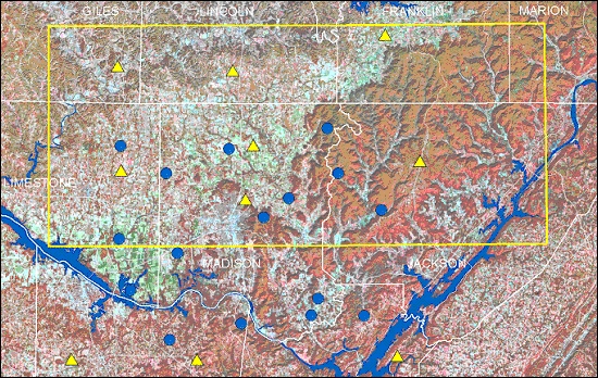
Figure 3: Map of the SMEX03 study domain over northern Alabama and southern Tennessee. The yellow triangles show the location of UDSA SCAN stations and the blue dots show the location of soil moisture and temperature profile stations operated by Alabama A&M University.
These missions were supported with ground sampling and measurements conducted by scientists and students from the Global Hydrology and Climate Center and Alabama A&M University. Dr. Laymon coordinated local preparations and logistical operations. Each day, eleven sampling teams dispersed to 59 sampling sites scattered across 50 x 125 km study area (Figure 3). These teams logged over 25,000 miles in the 10-day period. The second phase of the experiment took place in central Oklahoma from July 4 -19, and the final phase took place in Brazil in December. Data QC and associated documentation is complete for nearly all data sets and in preparation for delivery to NSIDC for archive and public access.
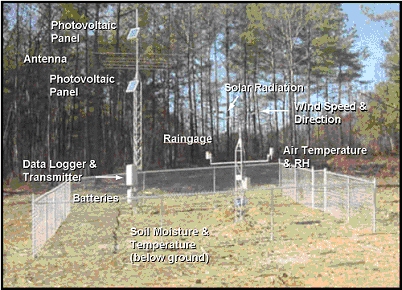
USDA SCAN station in northern Alabama
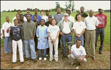
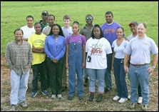
Participants in SMEX03-Alabama field campaign.
Acknowledgements:
This research was supported by NASA through grant no. 291-07-75-90 to Universities Space Research Association and grant no. NCCW-0084 to Alabama A&M University, Center for Hydrology, Soil Climatology and Remote Sensing.