


Experiments
The Southern Great Plains 1997 Hydrology Experiment (SGP97) built upon the success of the Little Washita ’92 and ‘94 experiments in demonstrating the viability of L-band radiometry for remotely sensing surface moisture. The insight gained from these experiments and the emerging research needs from GEWEX Continental-scale International Project (GCIP) formed the basis of the scientific objectives of SGP97. In small watershed studies, the distribution of soil moisture is largely attributed to the heterogeneity of soil properties and water extraction by different vegetation types. At the larger spatial scale of the SGP97 domain, soil moisture dynamics is largely affected by atmospheric controls on the land surface energy and water balance. As such, whereas SGP97 was originally conceived as an airborne experiment for daily mapping of surface soil moisture, it was expanded to meet broader interdisciplinary interests.
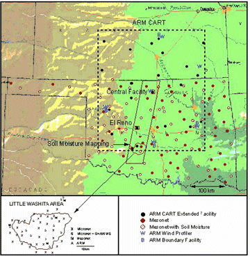
Figure 1: Map showing the location of the SGP97 mapping domain
relative to instrument networks and the three intensive sampling areas.
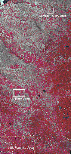 The core of SGP97 was large scale mapping of soil moisture with aircraft. This experiment mapped surface soil moisture over an area of ~10,000 km2 (order of magnitude larger than previously observed) at a spatial resolution of 800 m. Ground validation observations were focused in three areas, the Little Washita River watershed southwest of Chickasha, OK, the near the ARS facility at El Reno, OK and near the ARM CART Central Facility near Lamont OK (Figure 1). The Little Washita watershed, which has been the focus of extensive hydrologic research for over 35 years and covers an area of 603 sq. km, is dominated by rangeland and pasture (63%) with significant areas of winter wheat and other crops (Figure 2 right). The area around El Reno comprises mostly grassland and the area around the ARM CF comprises mostly winter wheat fields and pasture (Figure 2).
Investigators from the Global Hydrology and Climate Center supported ground-sampling efforts in the Little Washita watershed and near the Central Facility from June 21 to July 14, 1997. In addition to daily gravimetric and impedence probe measurements on designated fields, we deployed and operated a Bowen ratio energy balance flux station in the Little Washita watershed and soil profile stations (Figure 3 and 4) in the Little Washita watershed and at the Central Facility. We also conducted a study of multiscale temporal variability of soil moisture near the Central Facility.
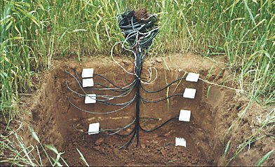
Figure 3: Installation of Water Content Reflectometers and temperature probes associated with profile stations.
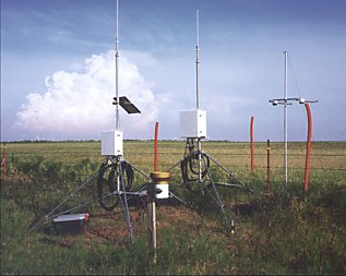
Figure 4: Profile stations installed during SGP97
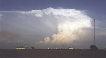 T-storm passes over the Central Facility during SGP97 (right)
Acknowledgements:
This research was supported by NASA through grant no. NCCW-0084 to Alabama A&M University, Center for Hydrology, Soil Climatology and Remote Sensing. Investigators with Universities Space Research Association were supported by SUB95-164 from Alabama A&M University.
More information can be found at: